Above is one of the maps we used for our battle of Brooklyn AKA: Long Island project, with the footprint of the game table drawn over it with the green lines.
BATTLE OF BROOKLYN 1776: The Empire Strikes Back! SCENARIO BRIEF:
General William Howe and his battered army have spent the last 4 months licking their wounds and rebuilding their strength in Nova Scotia, Canada, following their Pyrrhic victory at Bunker Hill and subsequent ejection from Boston by the then newly-appointed commander of the Continental Army, George Washington, with the aid of British guns captured at Fort Ticonderoga. But on July 26th, 1776 (less than a month after the signing of the Declaration of Independence) The Empire Strikes Back!
Under the command of Howe's older brother, Admiral Lord Richard Howe, a Royal Navy fleet enters the mouth of the New York Harbor with 200 ships, including 10 ships of the line, 20 frigates and 170 transports. A local paper reports: "The endless canopy of sail is truly a sight to behold."
The Brothers Howe have brought with them the largest British fighting force as yet ever deployed overseas, of 32,000 soldiers -- 10,000 of which are the dreaded Hessians. Unsure what reception they will receive from either rebel or loyalist, they anchor across New York Bay from Manhattan, off Staten Island, where there is ample space to bivouac, as well as bountiful foodstuffs to feed the troops while the high-ranking siblings take stock of the situation.
Fully aware that New York is the strategic gateway to the Hudson River and on into Canada, as well as a major mercantile center, and with orders from the Continental Congress to defend it, Washington is anxious. He takes his newly-cobbled-together Continental Army of 19,000 Yankee tradesmen and Southern planters and deploys them in small packets at key points in Manhattan and the surrounding areas. About 3,000 under Generals Sullivan and Stirling take up posts on Western Long Island, covering the high ground called Gowanus Heights.
Now, like General Artemis Ward at the Siege of Boston the year before, Washington can't be sure exactly where the British will make their main thrust, so he remains wary of committing his main force too early, afraid he may be duped by an enemy diversion. To improve the odds for his outnumbered army, Washington fortifies the Heights of Brooklyn with redoubts, trenches and gun-works, and posts blocking forces at each of the key approaches leading to there: Shore Road along the East River, Martense Lane Pass, Flatbush Pass, and Bedford Pass, all of which cut through the Gowanus Heights -- but fails to adequately defend the northern, potential end run, route through Jamaica Pass [see map].
Weeks go by and nothing happens save for a few forays by British gunboats up the East River and several sincere efforts by the Brothers Howe to parlay and put an early end to the rebellion before more blood is spilled (though General Howe's army, which had suffered high casualties at Bunker Hill, did not share his desire for peace). But Washington will have none of that nonsense. Battle it shall be...
So, on August 22nd, General Howe launches some 15,000 men in small boats across the tidal straight called The Narrows from his staging area in Staten Island to land at Denyse's Ferry, barely a mile away on the South-West tip of Long Island. Washington counters by sending 6,000 more men under General Putnam (of Bunker Hill fame) across the East River to Brooklyn. Howe ups the ante and extends his beachhead, landing more troops at Gravesend Bay, East of Denyse's Ferry, including 5,000 Hessians. British forces are estimated at 22,000 men, giving Howe more than a 2:1 advantage, plus the strength of the Royal Navy (and Marines) in support, if the winds prove favorable. For five days the opposing forces prance and parade in front of each other, some engage in skirmishing, while others loot nearby farms...
Then, at around 9 o'clock on the morning of August 27th, General Putnam sends word to Washington in Manhattan: he has heard the Sound of Guns coming from Jamaica Pass -- the battle of Brooklyn has begun...
AMERICAN VICTORY CONDITIONS:
For the Americans to win the battle they must bottle up the British on Long Island, thus preventing them from taking Brooklyn Heights -- the gateway to strategically vital New York City.
BRITISH VICTORY CONDITIONS:
For the British to win the battle they must seize Brooklyn Heights -- but to gain a glorious strategic victory and bring a quick end to the war, they must destroy Washington's army in detail.
* * * * * *
Below are a second and third map of the battle.
This second one has a note I added pointing out that the far South-Western edge of the American fortifications defending Brooklyn Heights seem to have reached very close to the far North-Eastern end of Gowanus Creek, which I saw as an important detail for us to include in our layout...
Both of the above are modern maps from history websites. The third map below, which is the last included in this post, is a brown up detail section of a map I later found that was made by a British engineering officer present at the battle. This map was included in a book published in London c.1790. I focus on the section covering the American fortifications and the Northern end of Gowanus Creek, which are shown as being literally adjacent. Also, as noted by me, this map shows a small additional "end cap" type section of the American defensive works located on the other side of Gowanus Creek...
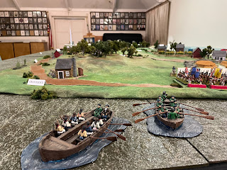
VIEW FROM SOUTH LOOKING NORTH ACROSS THE NARROWS TOWARDS THE NEWLY-ESTABLISHED BRITISH CAMP AT GRAVESEND, with Royal Navy warships and shallow draft "flatboats" headed towards the South-Western shore of Long Island (roughly the modern-day Brooklyn neighborhoods of Fort Hamilton and Bath Beach -- & some would also say Bensonhurst) in the foreground...
View of the newly-established British camp at Gravesend and the American troops deployed at the far Southern end of Gowanus Heights -- Brooklyn's high ground, much of which was wooded -- looking down at them. Soon they will go from exchanging looks to exchanging lead...
The Vechte House AKA: The Old Stone House, with cattails from the salt marsh around Gowanus Bay (sometimes called "Gowanus Cove") in the foreground and the mouth of Gowanus Creek at lower left...
Close-Up showing the iron numbers noting the date of its construction -- 1699 -- with the "one" written as a "J"...
View looking North-East of North end of the battlefield, with the bridge over Gowanus Creek visible at lower right, the American outer works beside it, Fort Putnam (which for us also stood in for Fort Greene & Fort Box) atop Brooklyn Heights on the left, and the southern end of Wallabout Bay poking out above it...
High angle View of Fort Putnam and the full line of American defensive works, as well as the the village of Bedford across the road in front of it, the North end of Gowanus Creek, the bridge across it, Gouwer's Mill and the Old Stone House on the right, and both the Porte Road and Flatbush Road stretching off into the distance where they meet and continue through Flatbush Pass (located in modern-day Prospect Park...
View showing the Brooklyn side of the East River and the c.1776 Manhattan skyline on the far side...
View from high above Jamaica Pass, which exits the table at its North-East corner, with Howard's Halfway House (AKA: Howard's Tavern) beside it and The King's Highway stretching off to the left, all the way to the British landing sites at Gravesend...
Closer view form high up, a little further South along King's Highway, with Fort Putnam and the American works visible on the right, the road through Bedford Pass leading from bottom right up past the village of Bedford on the near side of the road in front of the works below Brooklyn Heights, the village of Flatbush just barely visible at the lower left corner, and our Manhattan skyline in the distance...
Now we've come nearly 360° around the table (and Brooklyn!) at the table's South-East corner, with all 3 British camps visible, the tidal strait called "The Narrows" on the left, the series of wooded hills that are Brooklyn's highest ground -- called Gowanus Heights -- in the upper middle of the pic, and King's Highway running all the way from Gravesend to Jamaica Pass and Howard's Halfway House at the far end of the table in the upper right...
1st Pennsylvania State Regt. defend their post atop the Gowanus Heights AKA: Battle Hill...
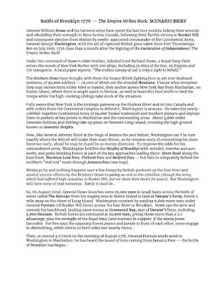
Reprise of the Scenario Brief, in JPEG format:
Reprise of Victory Conditions with respective Army Lists...
AMERICAN VICTORY CONDITIONS:
For the Americans to win the battle they must bottle up the British on Long Island, thus preventing them from taking Brooklyn Heights -- the gateway to strategically vital New York City.

~ BATTLE OF BROOKLYN, AUGUST 27TH 1776 ~
(Compiled for use with FIRE & MANEUVER rules)
AMERICAN ARMY LIST, BATTLE OF BROOKLYN, AUGUST 27, 1776:
Manhattan reserves under General Washington
19th Continentals.................................................................................18 figures
Brooklyn Heights redoubt & outer works under General Putnam
1st New York........................................................................................18 figs
12th Continentals.................................................................................18 figs
A Battery Continental Artillery Regt. ....................................................1 Hvy Gun + 4 crew
B Battery Continental Artillery Regt. ....................................................1 Hvy Gun + 4 crew
Gowanus Heights under General Sullivan
17th Continentals (Clark) at Flatbush Pass..........................................18 figs
22nd Continentals (Wyllys) at Bedford Pass.........................................18 figs
Penn State Rifles (Miles) at Jamaica Pass...........................................9 figs
C Battery Continental Artillery Regt. ....................................................1 Lt. Gun + 4 crew
Shore Road under General Stirling
1st Maryland (Gist).................................................................................9 figs
1st Delaware (Haslet).............................................................................9 figs
1st Penn State Regt. (Hand & Atlee) at Red Lion Inn/Martense Lane....9 figs
*Six Towns Militia...................................................................................6 (3 x bases w/2 skirmishers EA)
TOTAL: 144 officers & men + 4 High Command
*NOTE: These “Minuteman” skirmishers deploy prior to battle at American player’s discretion, may move & fire but not attack. When attacked they will give “defensive fire” then automatically disperse. If they inflict casualties by fire which would otherwise force a morale check, the target unit must check morale the same as if those casualties came from enemy regulars.
BRITISH VICTORY CONDITIONS:
For the British to win the battle they must seize Brooklyn Heights -- but to gain a glorious strategic victory and bring a quick end to the war, they must destroy Washington's army in detail.

BRITISH ARMY LIST, BATTLE OF BROOKLYN, AUGUST 27, 1776:


